General Aviation in the Swiss Alps
This year, I’m planning to visit AERO Friedrichshafen, which sits on the German border near the Swiss Alps. I’ve always dreamed of flying around the Swiss Alps and landing at interesting aerodromes, so I turned to the Euroga forums for recommendations on the best fields to visit.
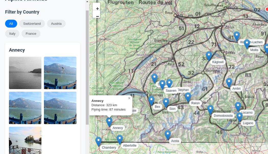
After receiving a helpful list of airfields, I needed a way to visualize them geographically. Using Claude AI, I simply pasted in the list of fields and asked it to plot them on a map for me. Like magic, the map appeared before my eyes.
Next, I wanted to plot the Swiss VFR routes on the same map to identify potential routings between fields for my journey home from the show. This is too complicated for Claude to do alone. To accomplish this, I extracted the routes from the AIP (as a screenshot), geo-referenced them in QGIS, and saved the result as a GeoTIFF. Then I modified my code to overlay this image on the map as well.

Since a picture is worth a thousand words, I also set up the map to pull images from Flickr for each airfield and its surrounding town. I hope this resource proves useful to other pilots planning their own Swiss Alps adventures.
You can use the application here:
General Aviation Alps Airfields viewer Link